
Arc: identity
Usage: IDENTITY <in_cover> <identity_cover> <out_cover> {POLY | LINE | POINT}{fuzzy_tolerance} {JOIN | NOJOIN}
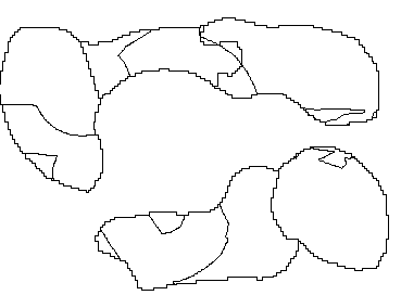
Arc: identity forestpoly solf solution
Producing identity of forestpoly with solf to create solution
Sorting...
Intersecting...
Assembling polygons...
Creating new labels...
Creating solution.PAT...
** Item "AREA" duplicated, Join File version dropped **
** Item "PERIMETER" duplicated, Join File version dropped
** Item "AREA" duplicated, Join File version dropped **
** Item "PERIMETER" duplicated, Join File version dropped
Arc:
Now let's look at the result. In ARC type :
Arc: items solution.pat

COLUMN   ITEM NAME        WIDTH OUTPUT  TYPE N.DEC
    1  AREA                   8    18     F      5
    9  PERIMETER              8    18     F      5
   17  SOLUTION#              4     5     B      -
   21  SOLUTION-ID            4     5     B      -
   25  FORESTPOLY#            4     5     B      -
   29  FORESTPOLY-ID          4     5     B      -
   33  GRID-CODE              4     8     B      -
   37  SOLF#                  4     5     B      -
   41  SOLF-ID                4     5     B      -
   45  INSIDE                 4     5     B      -
You can see the INFO file has both INSIDE and GRID-CODE ( tree types ) information stored. Look at the result in arcplot.
Arcplot: clear
Arcplot: arcs solution
Figure 30: Overlay of forests and solution area.
You can see the overlay of sole with the forest polygons. We only need the forest areas inside the solution area so let's extract that using select.
Arcplot: reselect solution polys INSIDE = 100
SOLUTION polys : 14 of 29 selected.
Look at the map, now that we have selected our areas.
Arcplot: clear
Arcplot: polygonshades solution GRID-CODE
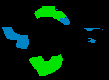
Figure 31: Polygonshades of our result map.
Now write the selection rule to a selection file.
Arcplot: writeselect final.sel
2 selected set(s) written to final.sel
0 Group-by rule(s) written to file
In ARC extract the selected polygons to a new coverage.
Arc: reselect solution final polys final.sel

 Reselecting POLYGON features from SOLUTION to create FINAL
 14 features out of 29 selected.
 Reselecting polygons...
Number of Polygons (Input,Output) =         29         15
Number of Arcs     (Input,Output) =         96         67
 Creating FINAL.pat...
65 unique nodes built for /W08/LANDUSE/GISCOURSE/FINAL
Arc :
Now we have our final map with the areas suitable for logging operations. Our last task is to calculate how much money will be made from the timber. We will do this next in INFO.

 go on .
 go back
 go home