
(sungis2:shane)[!]: arc
Copyright (C) 1989,1990,1991,1992 Environmental Systems Research Institute, Inc.
              All Rights Reserved Worldwide.
ARC Version 6.1.1  (December 23, 1992)

This software is provided with RESTRICTED AND LIMITED RIGHTS.  Use,
duplication, or disclosure by the Government is subject to the
restrictions as set forth in FAR 52.227-14 (JUN 1987) Alternate III
(g)(3) (JUN 1987), FAR 52.227-19 (JUN 1987), or DFARS 552.227-7013
(c)(1)(ii) (OCT 1988), as applicable.  Contractor/Manufacturer is
Environmental Systems Research Institute, Inc. (ESRI) 380 New York St.
Redlands, CA 92373.
Arc:
I let the system know which digitizer, display etc. I was using with the station command :
Arc: &stat 9999
Arc:
Then I used the ADS command to create my TIC coverage (in digitizer coordinates) which I called digcov.
Arc: ads digcov
 Editing coverage digcov
Creating DIGCOV
DIGITIZER TRANSFORMATION
Digitize a minimum of 4 tics.
Signal end of tic input with tic id 0
Tic id
I had to put in at least 4 TICs . I chose to enter 4 TICs of ids 1 to 4. So I entered '1' on the key pad followed by 'A' (equivalent to the return key on the keyboard). I then moved the cursor to the position on the map of my first TIC and pressed any key on the pad to enter the TIC. I repeated this for the 3 other TICs.
Arc: ads digcov
 Editing coverage digcov
Creating DIGCOV
DIGITIZER TRANSFORMATION
Digitize a minimum of 4 tics.
Signal end of tic input with tic id 0
Tic id 1*
Tic id 2*
Tic id 3*
Tic id 4*
Tic id
To finish I pressed key '0' on the cursor and 'A' to finish up.
Tic id 1*
Tic id 2*
Tic id 3*
Tic id 4*
Tic id 0*
Enter initial Boundary (from digitizer)
I then had to enter the boundary (edges of the map) and answer a few questions.
Are duplicate arcs permissible? <1=Yes,2=No>:
I entered '2' and the following came up on the screen. (Well one is a few - right ?)
Copyright (C) 1989,1990,1991,1992 Environmental Systems Research Institute, Inc.
              All Rights Reserved Worldwide.
ADS Version 6.1.1  (December 23, 1992)

1) Add Arcs      3) Add Labels      5) Draw Coverage   7) Add Tics
2) Remove Arcs   4) Remove Labels   6) Define Window   8) Set Options
9) Exit          Enter function :
I just wanted to save this and see what I had done so I entered '9' . I then had to save and quit.
9) Exit          Enter function :
Exit ADS
Press "9" to exit, "1" to save and continue,
      or anything else to continue.
I entered '9'. The software then asked me did I want to save my changes. So I entered 'y' on the keyboard.
Press "9" to exit,  "1" to save and continue,
      or anything else to continue.
Files closed - exiting ADS
Save changes  : y
Saving changes for DIGCOV
   BND replaced into DIGCOV
Arc:
To look at what I had done I started ARCEDIT.
Arc: arcedit Copyright (C) 1989,1990,1991,1992 Environmental Systems Research Institute, Inc. All Rights Reserved Worldwide. ARCEDIT (COGO) Version 6.1.1 (December 23, 1992) Arcedit:
I selected the coverage I had just created.
Arcedit: editcoverage digcov

The edit coverage is now /HOME/USR/SHANE/DIGCOV
WARNING the Map extent is not defined
Defaulting the map extent to the BND of /HOME/USR/SHANE/DIGCOV

Arcedit:
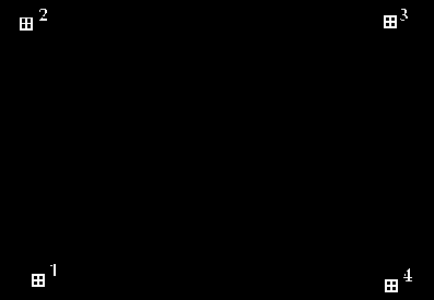
ARCEDIT will only display the features you request it to display, in this case we only have TICs so type :
Arcedit: drawenvironment tic id
Arcedit: draw
Figure 1 : TICs and IDs in ARCEDIT display.
I then created a new coverage from the TIC coverage which I then transformed into real world units. The new coverage had exactly the same TICs as my TIC coverage. This was performed using the create command.
Arcedit: create base digcov
Creating /HOME/USR/SHANE/BASE
The edit coverage is now /HOME/USR/SHANE/BASE
Use COORDINATE DIGITIZER DEFAULT to orient /HOME/USR/SHANE/BASE if required.
I didn't need to do anything more in ARCEDIT so I saved the new coverage and quit.
Arcedit: save
Saving changes for /HOME/USR/SHANE/BASE
   BND replaced into /HOME/USR/SHANE/BASE
Arcedit: quit
Leaving ARCEDIT...
Arc:
I then examined the TICs by using the list command.
Arc: list base.tic
Record  IDTIC         XTIC         YTIC
     1      1       17.275        7.407
     2      2       17.230       16.722
     3      3       24.018       17.060
     4      4       23.834        6.336
I wanted to change this coverage so that it was in real world units and not digitzer units so I had to change the TIC values, the best way to do this was using INFO.
Arc: info
INFO  9.42  11/11/86  52.74.63*
 COPYRIGHT 1986 HENCO SOFTWARE, INC.
 PROPRIETARY TO HENCO SOFTWARE, INC.
 US GOVT AGENCIES SEE USAGE RESTRICTIONS IN HELP FILES (HELP RESTRICTIONS)
 ENTER USER NAME>
The user name is always ARC, also at this point it is useful to press the caps lock key as INFO expects everything to be entered in capital letters.
ENTER USER NAME> ARC
ENTER COMMAND >
I selected the TIC file of my new coverage.
ENTER COMMAND >SELECT BASE.TIC
       4 RECORD(S) SELECTED

 ENTER COMMAND >
To change the values of the XTIC and YTIC items I used the UPDATE command.
ENTER COMMAND >UPDATE PROMPT
 RECNO?>
I changed record 1 ( TIC 1) first. I didn't need to change the TIC id so I just pressed the return key on that item. I did change the XTIC and YTIC values to the coordinates I had read off the map ( which were handily enough in UTM format).
                1
 IDTIC           =    1
 XTIC            =      17.275
 YTIC            =       7.407
IDTIC>
XTIC>17250
YTIC>7407
 RECNO?>
I then changed the other 3 TICs to UTM coordinates.
RECNO?>2
                2
 IDTIC           =    2
 XTIC            =      17.230
 YTIC            =      16.722
IDTIC>
XTIC>17230
YTIC>16722
 RECNO?>3
                3
 IDTIC           =    3
 XTIC            =      24.018
 YTIC            =      17.060
IDTIC>
XTIC>24018
YTIC>27060
 RECNO?>4
                4
 IDTIC           =    4
 XTIC            =      23.834
 YTIC            =       6.336
IDTIC>
XTIC>23834
YTIC>6336
 RECNO?>
All four TICs have been changed so I press the return key to finish. To see what had changed I used the LIST command .
ENTER COMMAND >LIST
 $RECNO   IDTIC         XTIC         YTIC
      1       1   17,250.000    7,407.000
      2       2   17,230.000   16,722.000
      3       3   24,018.000   27,060.000
      4       4   23,834.000    6,336.000

 ENTER COMMAND>
Everything was OK , so I saved and quit using the Q STOP command.
ENTER COMMAND>Q STOP
Arc:
Since the TICs were now in UTM coordinates (zone 54), I set the projection of the base coverage to UTM using the projectdefine command.
Arc: usage projectdefine Usage: PROJECTDEFINEArc: projectdefine cover base Define Projection Project: projection utm Project: zone 54 Project: units meters Project: parameters Arc:
To see what had happened to the coverage I used the describe command.
Arc: describe base
                 Description of SINGLE precision coverage base

         ARCS                              POLYGONS

Arcs          =          0            Polygons    =          0
Segments      =          0            There is NO Polygon Topology.
0    bytes of Arc Attribute Data      0    bytes of Polygon Attribute Data

         NODES                             POINTS

Nodes =          0                    Label Points =          0
0    bytes of Node Attribute Data

         TOLERANCES                             SECONDARY FEATURES

Fuzzy   =            0.002 N               Tics   =               4
Dangle  =            0.000 N               Links  =               0

                             COVERAGE BOUNDARY

Xmin =                   14.977            Ymin =                    4.640
Xmax =                   25.415            Ymax =                   19.033

Continue?
                                   STATUS

The coverage has not been Edited since the last BUILD or CLEAN.

                     COORDINATE SYSTEM DESCRIPTION

Projection                  UTM
Zone                         54
Units                    METERS             Spheroid      CLARKE1866
Parameters:
Arc:
I could see that although the projection was correct, the extents of the coverage, Xmax, Ymax, Xmin and Ymin showed that it was still in digitizer coordinates. To change the coverage to real world coordinates I used the transform command.
Arc: transform digcov base
Transforming coordinates for coverage digcov

Scale (X,Y) = (1001.903,1717.744)  Translation = (-58.946,-19996.199)
Rotation (degrees) = (0.065)  RMS Error (input,output) = (1.841,2503.647)

tic id         input  x         input  y
               output x         output y          x error          y error
------ ---------------- ---------------- ---------------- ----------------
     1           17.275            7.407
              17250.000         7407.000            7.350        -2467.857
     2           17.230           16.722
              17230.000        16722.000           -7.128         2393.327
     3           24.018           17.060
              24018.000        27060.000            6.170        -2071.431
     4           23.834            6.336
              23834.000         6336.000           -6.392         2145.961
Arc:
Now when I used the describe command. The extents had changed to :
                          COVERAGE BOUNDARY

Xmin =                14951.829            Ymin =                -1096.154
Xmax =                25426.074            Ymax =                29101.348
The first stage was now complete , I had my TIC coverage in real world units. I then had to create the actual coverage's I needed for my analysis. You will see how that was done next.

 go on .
 go back
 go home