
DIGITAL DATA RESOURCES
To help with the selection process the company has some digital data they will use in the GIS to devise their selection site.
Road Vector Data
a vector coverage in ARC/INFO format of the roads in the Oakwood areas called ROADLINE.
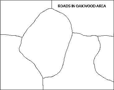
Figure 2: Roads in the Oakwood area.
Contour Data 1
Firstly a polygon coverage in ARC/INFO format of the height of the land in 200m contour intervals. The coverage is called CONTPOLY.
In the info file CONTPOLY.PAT is an item called spot that holds the minimum height of that polygon.
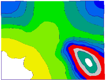
Figure 3: Relief map of the Oakwood area

 go on .
 go back
 go home