
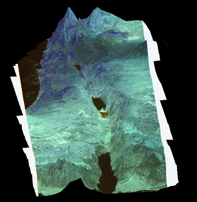
USING TINS FOR VISUALIZATION
Here is a fantastic example of 3-D visualization of a DEM. The image below was prepared in ARC-INFO. It was a fairly straightforward task. The steps involved were :
- Prepare points with heights of the Holy Land in ARC-INFO from DCW dataset.
- Create a TIN from the points of the Holy Land.
- Generate contours from the TIN.
- Use the contours to REGISTER the Landsat TM image of the Holy Land in ARC-INFO.
- Use SURFACEDFAULTS to do all the dirty work.
- Use SURFACEOBSERVER RELATIVE to set up the azimuth
and zenith angles of the observer (how high up you are, and from where you are looking e.g. from the south or the north).
- Use SURFACEDRAPE to drape the TM image over the Holy Land TIN.
- Er umm that's it.

 go back to the course
 go home
 A word from the author
Shane Murnion sdm@sfc.keio.ac.jp