
Arc:  buffer riverline waterbuf2 # # 1000 # line
Buffering......
Sorting.......
Intersecting.....
Assembling Polygons....
Creating New Labels.....
Finding inside polygons.....
Dissolving ....
Creating waterbuf2.PAT...
Arc:
Look at the resulting buffer in ARCPLOT, type :
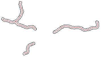
Arcplot: clear
Arcplot: linecolor 1
Arcplot: arcs waterbuf2
Arcplot: linecolor 2
Arcplot : arcs riverline
Figure 11c: Buffer of the river vectors
Arc: buffer shrinepoint shrinebuff # # 10000 # point
 Buffering ...
 Sorting...
 Intersecting...
 Assembling polygons...
 Creating new labels...
 Finding inside polygons...
 Dissolving...
 Creating shrinebuff.PAT...
Arc:
Now look at all the buffers we have created . At the ARCPLOT prompt type :
Arcplot: clear
Arcplot: arcs waterbuff1
Arcplot: arcs waterbuff2
Arcplot: arcs shrinebuff
Arcplot: linecolor 4
Arcplot: arcs roadbuff
Arcplot:
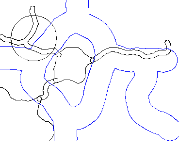
Figure 11d: All the buffers.
 go on .
 go back
 go home